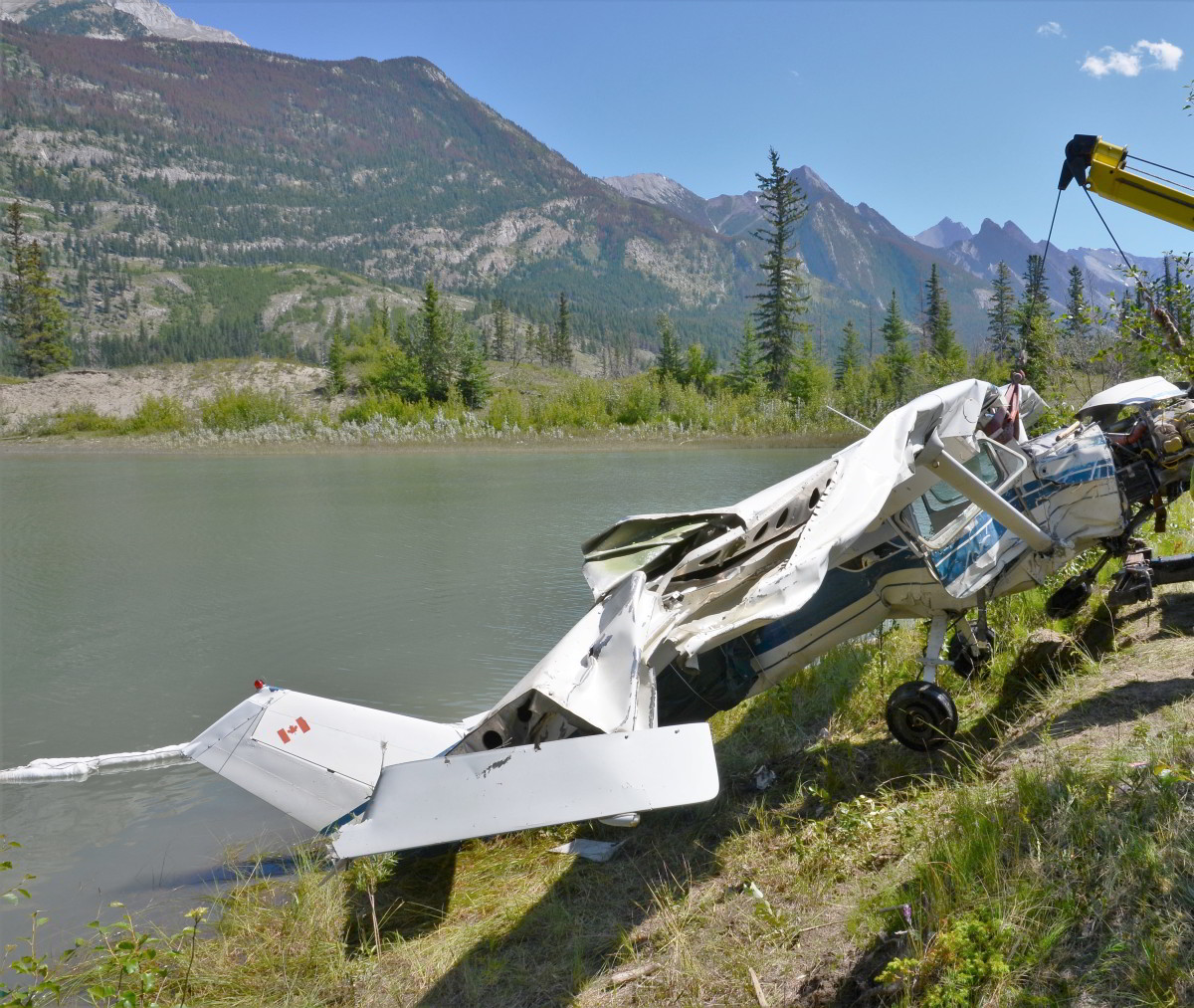
Cessna 150J C-GCEA
Jasper, Alberta
21 July 2019
Transportation Safety Board of Canada – Link
Reproduction of this publication is meant solely for educational purpose to help prevent accidents and inform the public and Pilots.
The occurrence
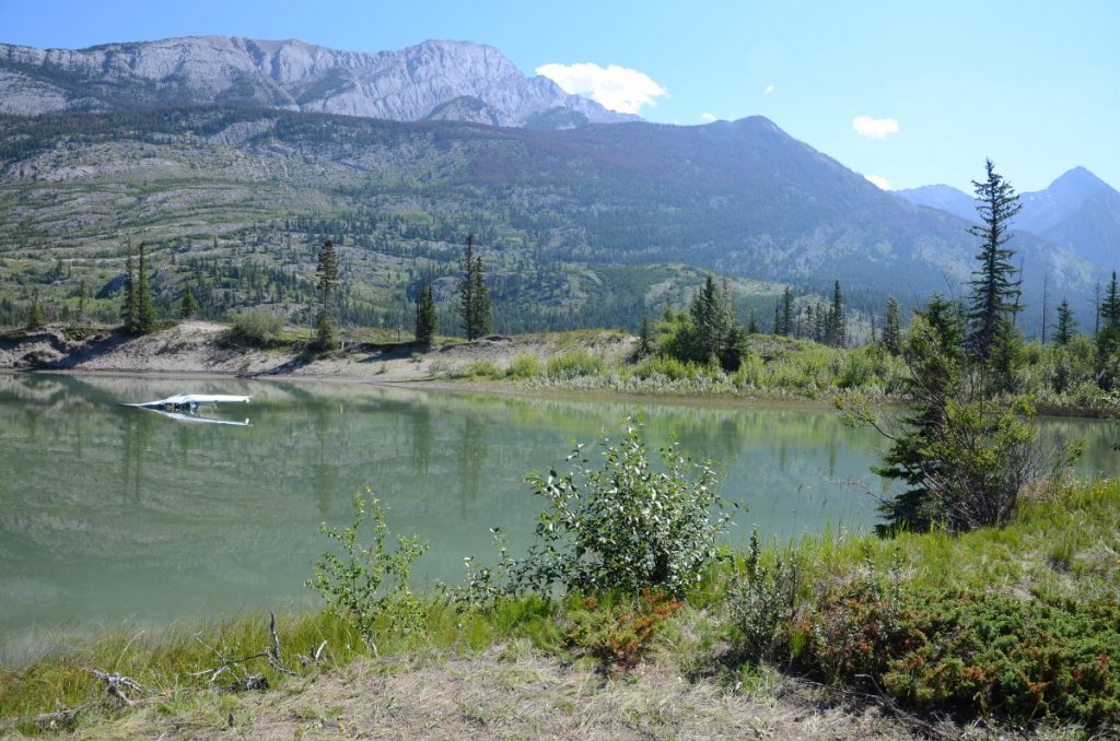
On 21 July 2019 , at approximately 1300,Footnote1 the pilot and the passenger arrived at Jasper Airport to prepare the Cessna 150J aircraft (registration C-GCEA) for a flight to Hinton/Entrance Airport, Alberta. The aircraft took off to the northwest on Runway 31 at 1323, continued climbing for 25 seconds, and reached an altitude of approximately 150 feet above ground level. At 0.5 nautical miles (nm) from the airport, the aircraft stalled and entered a spin to the left, and impacted the water in a pool of the Athabasca River. The aircraft was equipped with a 121.5 MHz emergency locator transmitter, which activated on impact.
Immediately following the accident, a pilot at the airport who had seen the accident called 911 on his personal cellphone. Another eyewitness drove to the scene within minutes of the impact and assisted both the pilot and the passenger to shore.
A number of passersby on Highway 16 stopped to administer first aid, and Jasper Emergency Medical Services responded shortly afterward. The pilot, who was severely injured in the accident, was transported to Edmonton by air ambulance. The passenger was fatally injured.
All of the major components of the aircraft were accounted for at the accident site. The wing flaps were found in the retracted position. The aircraft was within the certified weight and balance limits. Based on examination of the wreckage and the photo and video information collected, it was determined that the engine and flight controls had been operating normally prior to impact.
Environment and Climate Change Canada’s Jasper Warden station, located 5 nm south of the accident site, records hourly weather information. The information recorded at 1300 indicated the following:
- Wind direction variable at 1 to 3 knots
- Temperature 24.4 °C, dew point 6.5 °C
An aviation routine weather report (METAR) for Edson Airport, located 68 nm northeast of the accident site, recorded the following weather at 1300:
- Wind direction 104° magnetic at 11 knots, gusting to 17 knots
- Visibility greater than 9 statute miles
- Temperature 22 °C, dew point 6 °C
- Altimeter setting 30.13 inches of mercury
At the time of takeoff, the winds at Jasper Airport were southerly at 5 to 10 knots, and the density altitude, based on the altimeter setting at Edson Airport, was 5088 feet above sea level.
The aircraft was equipped with a Garmin GPSMAP 196. It was recovered at the accident site and was sent to the TSB Engineering Laboratory for analysis. Just before the loss of control, the GPS (global positioning system) recorded a reduction in ground speed from 83 mph to 64 mph and a course change approximately 30 degrees to the left of the runway track. During the reduction in airspeed, the altitude remained constant at about 150 feet above ground level for almost 5 seconds before the aircraft departed controlled flight and entered the aerodynamic stall and left-hand spin.
Class of investigation
This is a class 5 investigation. Class 5 investigations are limited to collecting data, which are then stored in the modal database. If TSB investigators deployed to the occurrence site, a short description of the occurrence will be added to this page once the investigation has been completed. These investigations are generally completed within 90 days. For more information, see the Policy on Occurrence Classification.
The TSB is an independent agency that investigates air, marine, pipeline, and rail transportation occurrences. Its sole aim is the advancement of transportation safety. It is not the function of the Board to assign fault or determine civil or criminal liability.